William Madison Stockton
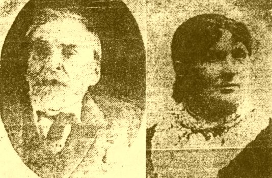
These are the photos referenced at
the end of the article that appeared in the 1913 newspaper. They are
obviously poor quality being copied from 1913 newsprint, but since we have
no other photos of William and Nancy Farris Stockton, these will have to
do for the time being. The photos were obviously taken at different ages.
You can click on the small photos to bring up a larger image.
We'd love to find out who has the originals if they still exist.
Statesman (Boise ID), 26 October 1913, pII-4
Pioneer Department of the Sunday Statesman
edited by Eva Hunt Docker*
"Daddy Stockton", as W. M. Stockton is lovingly known to all his friends, is now located in Boise, after living in a number of Idaho cities from Lewiston south. Few men have had more to do with the early building of as many towns in Idaho as has Mr. Stockton. He went into the Rogue River country, Oregon in 1860, settled in Lewiston from May of '62 until the fall, when he went to the Grande Ronde valley. He freighted between Idaho City and Washoe for seven years bringing many of the supplies for the early settlers of the Basin towns. Later he freighted between Winnemucca and Silver City, moving to Silver City when the camp was in its infancy.
After a few years he went to Weiser, where he first engaged in the logging business and later in the hotel business. In 1884 he took up 160 acres, the present townsite of Glens Ferry, where he lived until two years ago when he came to Boise, purchasing "Fairlawn", the former home of Mr. and Mrs. Nathan Smith. For the past 18 years Mr. Stockton has been unable to walk and goes about in a wheel chair.
Few emigrants had more encounters with the Indians in crossing the plains than did Mr. Stockton and his wife, although no fatalities happened to any of their party. They started from Clarinda, Iowa, in 1860. Three days out, when at Nebraska City, they buried their two year old boy. Their train consisted of three families with seven wagons until they reached the Portneuf river. At Ft. Hall they found a bunch of wagon irons, mute reminder of an Indian massacre the year before.
At Portneuf a company of soldiers were located and informed the party that it was not safe for them to go down the Humbolt river on account of the fact two Indian tribes, led by Buffalo Horn and Winnemucca, were at war with the whites. The party waited 10 days when 100 wagons and 300 people had assembled. They were given firearms then and told to go, but to use every precaution.
The trip down the Humbolt river was 480 miles. At Lawson [sic-I believe this is Lassen] Meadows the party was advised to break up since there was not water enough nor feed for so large a company. Guards were changed every night and the old emigrant trail into Shasta valley, Cal., was reached at Honey Lake valley.
Indians were met all along the route, but nothing serious happened.
*picture of W. M. Stockton and his wife accompany the article
Further notes from Jane Mason:
I immediately had to get out maps and trace the route. As only three families reach Ft. Hall I assume some of those who started left off in Colorado per the alleged original plan. Perhaps the single men? I found the wonderful "picture trail" following much of their exact route on the following site and a good overview on the next site -
pictures of the Humboldt section of the California trail:
http://www.emigranttrailswest.org/cscenes2.htm
excellent review of the California trail:
http://www.emigranttrailswest.org/caltrail.htm
The Farris-Stockton train left the California trail and travelled through Honey Lake; the website contains the following re the Honey Lake Road LANDER ROAD (1858):
Frederick Lander laid out the Lander Road from South Pass to Fort Hall, and then improved the existing trail from Ft. Hall to City of Rocks. This became a primary route for emigrants beginning in 1858. Lander made other significant improvements on sections of the Applegate Trail and Nobles Trail in 1860, mainly enlarging water holes. The improvements from the Humboldt River to Honey Lake near Susanville led to this section of trail being known as the Honey Lake Road.

